What Affects Rates in Sandy
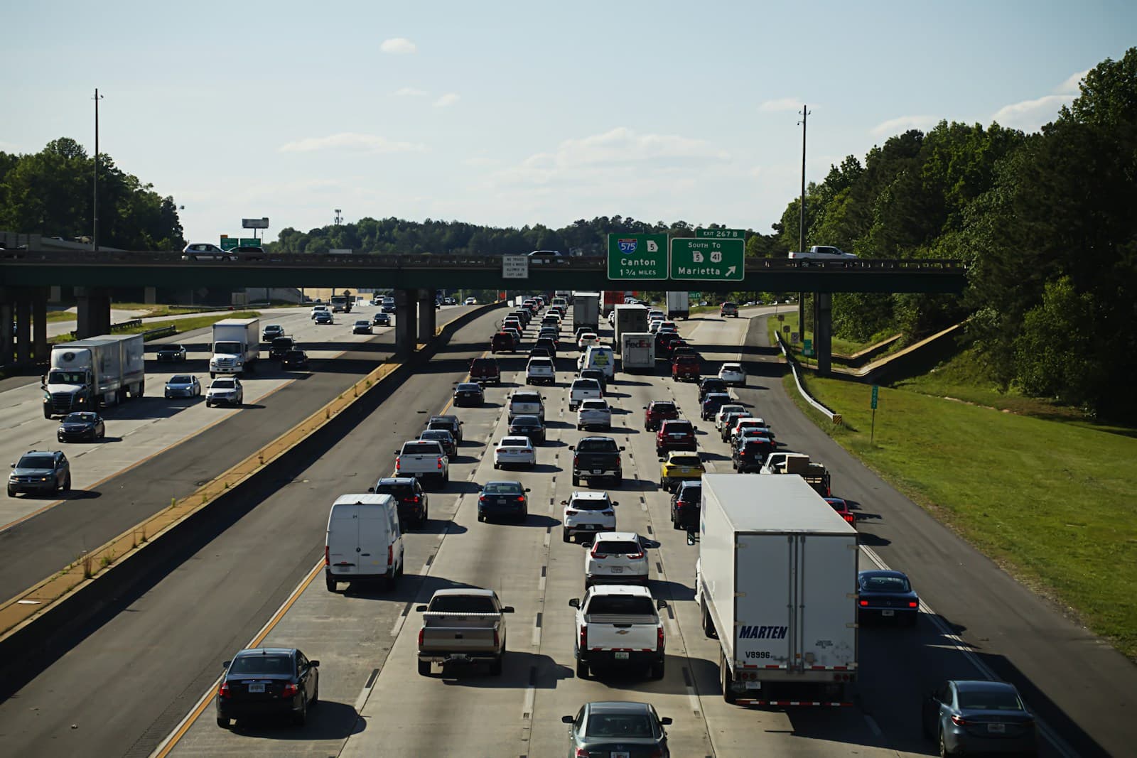
- The I-15 stretch through Sandy sees heavy weekday commuter traffic, particularly at the 9000 South and 10600 South interchanges. Morning backups between 7-9 AM and evening congestion from 4-6 PM increase rear-end collision frequency. Drivers using this corridor daily typically see 12-18% higher rates than those commuting locally on surface streets.
- Sandy serves as a gateway to Big Cottonwood and Little Cottonwood canyons via Wasatch Boulevard and 9400 South. Winter ski traffic and summer recreation generate elevated collision and comprehensive claims from November through March. Vehicles parked near canyon mouths face higher theft risk for ski equipment and outdoor gear.
- East Sandy neighborhoods near the Wasatch foothills feature newer homes and lower claim frequencies, while areas west of State Street show higher vehicle theft rates and uninsured motorist encounters. The 30-40 year age difference in housing stock correlates with a 15-25% rate variation across ZIP codes within city limits.
- Sandy's position at the valley edge creates variable winter conditions—foothill areas receive more snow accumulation than western sections near Jordan River. January through February ice storms on Wasatch Boulevard and 9400 South drive seasonal collision spikes. Hail from summer thunderstorms moving off the mountains impacts comprehensive claims in eastern neighborhoods.
- South Towne Center and The Cairns district generate consistent parking lot incidents and minor collision claims. The 10400 South commercial corridor between State Street and I-15 sees elevated accident frequency during holiday shopping periods. Drivers working in these zones face marginally higher rates than residential-only commuters.
Find the minimum coverage that meets your state's requirements
Compare liability-only rates from carriers in your state — and see what discounts you qualify for.
Get Your Free QuoteCoverage Recommendations
Cost estimates are based on available industry data and vary by driver profile. These are not insurance quotes.
Liability Only
Adequate for I-15 fender-benders but leaves you exposed in multi-vehicle canyon road pileups common during winter storms.
$45-$65/monthEstimated range only. Not a quote.
Liability + Uninsured Motorist
West Sandy neighborhoods near 7800 South show higher uninsured driver rates—adds $12-$18/month but covers gaps minimum coverage leaves open.
$57-$83/monthEstimated range only. Not a quote.
Full Coverage
Justified for newer vehicles given Sandy's canyon hail risk and parking lot theft near South Towne Center, but costs $140-$190/month—not worth it for cars under $5,000 value.
$140-$190/monthEstimated range only. Not a quote.
Collision Only Add-On
Makes sense if you avoid canyon parking and live in lower-theft east Sandy areas—saves $20-$30/month versus full coverage.
$95-$130/monthEstimated range only. Not a quote.